
Project Overview
Banao Technologies partnered with a Canadian environmental safety initiative to build an AI-powered wildfire risk assessment platform, Mapapp. The solution identifies high-risk wildfire zones using aerial visualization and geospatial intelligence, helping communities predict and mitigate wildfire exposure risks. It empowers users with insights into fire likelihood, combustible materials, and safe escape times, driving proactive wildfire prevention and community resilience.
Industry
Environmental & Safety TechBusiness type
Environmental Risk Analysis
Build your idea
Consult our expertsImpact After Launch
Following its launch, Mapapp revolutionized how wildfire risks are monitored and mitigated in Canada. The platform improved accuracy in identifying high-risk zones and enabled real-time safety alerts for communities. Property owners, developers, and environmental agencies now rely on Mapapp to make data-driven decisions about building safety and emergency planning.
Key results achieved after deployment
0+
accuracy in identifying high-risk wildfire zones,
0+
reduction in wildfire response time through real-time alerts, and
0%
improvement in proactive community safety and preparedness.
Challenge
Canada’s dense forest regions pose significant wildfire threats to nearby residential and commercial properties. Traditional risk assessment methods lacked real-time insights and precision, leaving communities underinformed and vulnerable. The challenge was to create a system that visualizes risk dynamically and predicts wildfire behavior with accuracy.
Our Solution
Banao Technologies developed an AI-driven web application using advanced geospatial analysis and aerial visualization. The solution identifies wildfire-prone zones in real time and provides critical data on combustible materials, escape times, and historical fire activity, enabling users to take proactive safety measures.
Features Implemented:
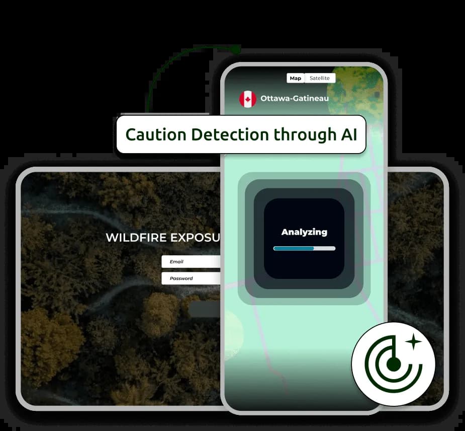
- AI-driven geospatial wildfire detection
- Interactive map visualization of high-risk zones
- Real-time wildfire alerts and safety notifications
- Escape time estimation for selected areas
Key Features Implemented
A data-driven AI mapping platform that enhances wildfire prevention and response planning.
AI-Powered Risk Detection
Analyzes environmental data to identify high-risk wildfire zones and exposure levels using aerial visualization.
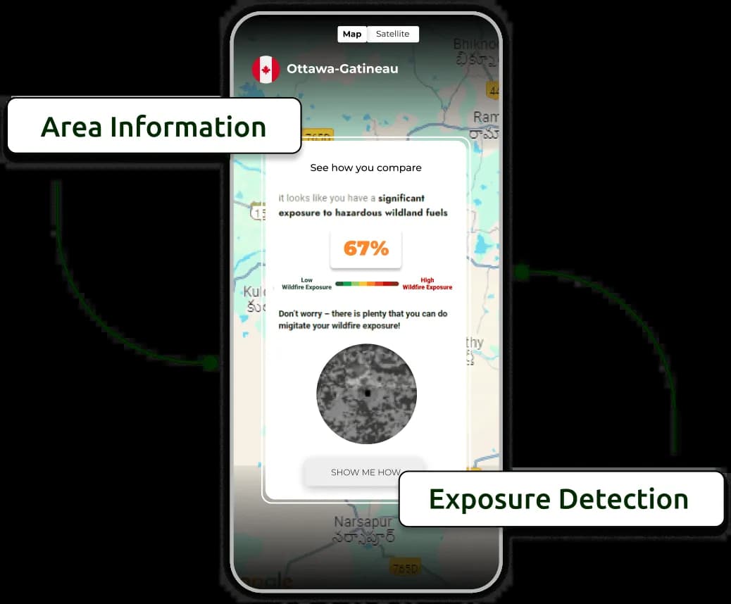
Interactive Mapping Dashboard
Provides an intuitive geospatial interface to explore real-time fire likelihood, combustible materials, and evacuation readiness.
Caution Detection Model
Predicts and alerts users of imminent wildfire risks, improving safety response and reducing potential damages.
Escape Time Estimator
Calculates how quickly a wildfire could reach selected zones, guiding users in emergency preparedness planning.
Where we're located


Frequently Asked Questions
How accurate is the wildfire risk assessment?
The AI models achieve approximately 85% accuracy in identifying high-risk wildfire zones based on geospatial and aerial data.
Does the app provide real-time updates?
Yes, the system continuously analyzes environmental data and provides real-time alerts when fire risks are detected nearby.
Can users assess risk for specific properties?
Absolutely. Users can highlight any area on the map to receive detailed risk scores, nearby forest proximity, and escape time estimates.
Is the platform scalable to other regions?
Yes, Mapapp’s architecture supports scalability and can be adapted to assess wildfire risks in other countries or environmental contexts.